

A web platform for all your geotechnical projects
Developed by terrasol, part of the setec group, a consulting firm specializing in high value-added geotechnical engineering, and renowned for its expertise in calculation software, including Talren, Foxta, & K-Réa.

Orbow hosts all your projects in a secure account and stores all of the associated ground investigation data.

Numerous decision-making tools are available to analyse this data and build your geological and geotechnical models (3D views, cross-sections and longitudinal profiles, statistical tools).

A strategic solution for your unique needs

Project owners
Project owners have a major stake in capitalising on the data acquired on their sites and being able to share this data effectively with their engineering and construction contractors. Orbow makes this management and sharing much easier.

Consultancy firms
Large engineering firms face the challenge of managing, processing and analysing a huge amount of soil data of all types in their projects. Orbow makes these complex workflows natural.

Engineering offices
Geotechnical engineering offices can easily customise Orbow to meet their needs, capitalising on the data received to conduct their studies, and the daily benefits of using the integrated analysis and calculation tools.

Building companies
Orbow adapts to both drilling companies and foundation companies. The application allows them to easily visualise all work sites at the proposal or execution stages and access acquired field data, facilitating feedback and experience sharing.
Everything you need to complete your projects from A to Z

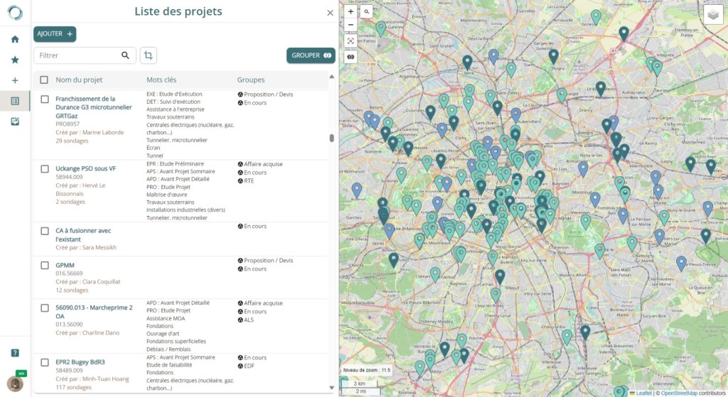
Centralise your projects
A clear overview of your data
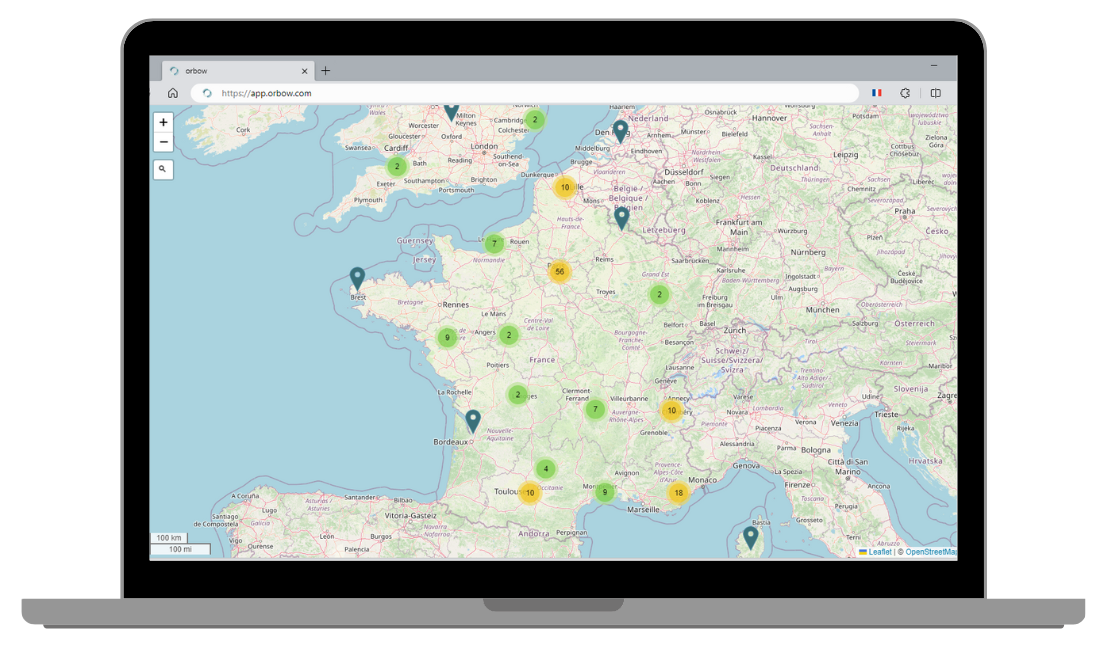
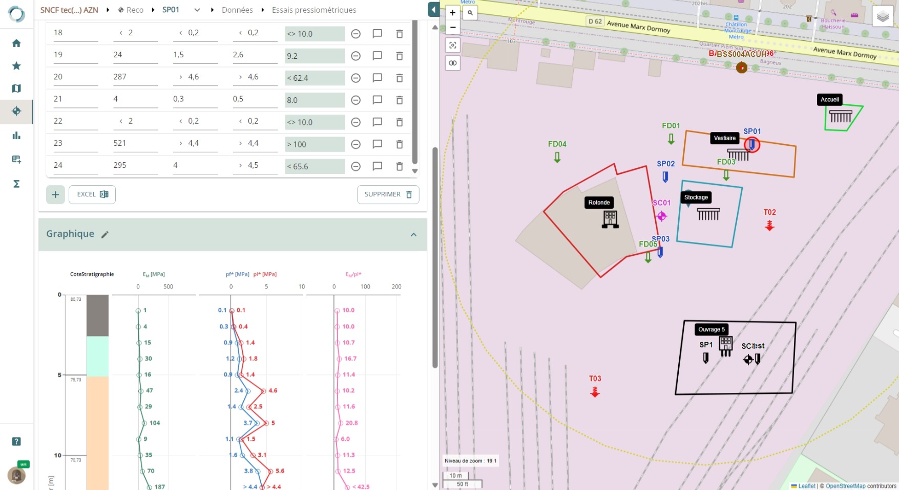
Orbow’s interface focuses on displaying data on a dynamic, customisable map.
Creating a project on the map is just a click away. Give your colleagues access to work on the project with you. You can also share the project with another company’s account to start collaborating.
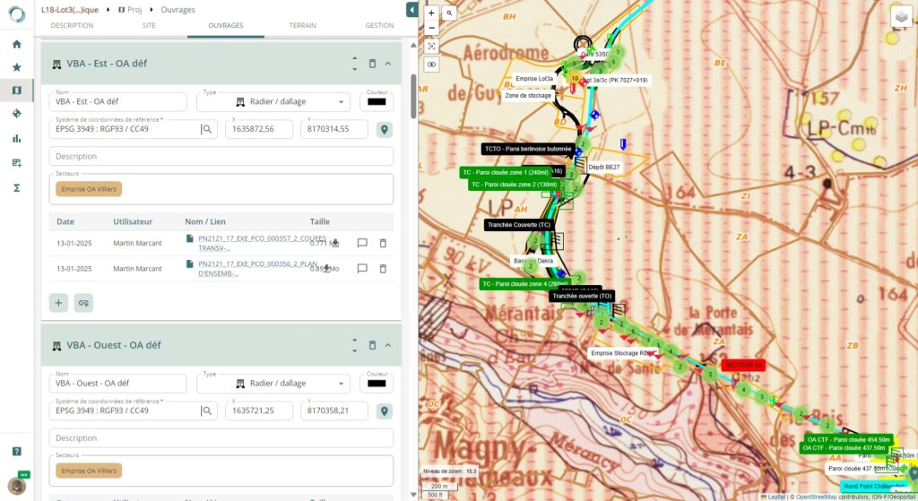
Map your projects in detail
Orbow‘s mapping tools allow you to easily position your work on the map, whatever the reference system, import background maps (dxf, geojson, geotiff formats), annotate the map, draw to divide your projects into sectors, and overlay different map flows (recent and old orthophotographs, geological maps, French public borehole locations, risk maps, etc.).
You can also upload your documents, plans and photos directly into the application.

All your soil data
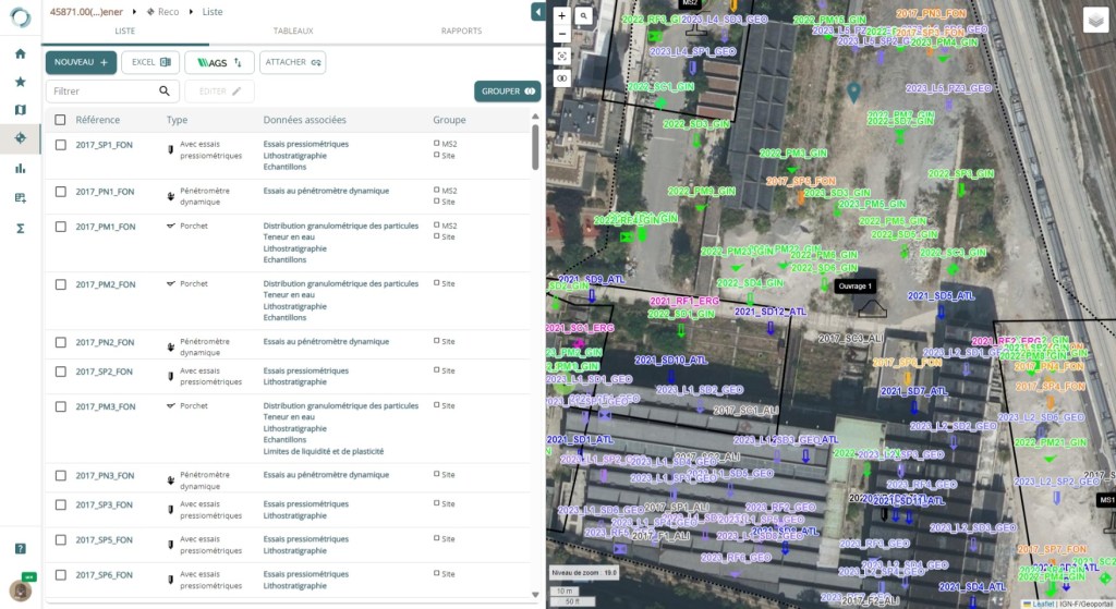
Import and manage data
Orbow‘s soil investigation database is complete and natively 100% compatible with the AGS format.
Easily import/export your data in batches (csv, Excel, ags formats) and manipulate it in the same way as in Excel or via dedicated forms.
Consult and automatically integrate public data from French BRGM’s BSS (more coming soon).
Interpret, analyse, export
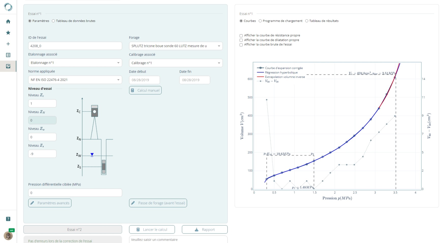
Interpret soil data directly in the application.
Analyse your pressuremeter tests: our Pressiow module allows you import raw data files from Lutz, LIM and Apageo equipment.
Export your reports: generate pdf reports in just a few clicks.


Analyse your data

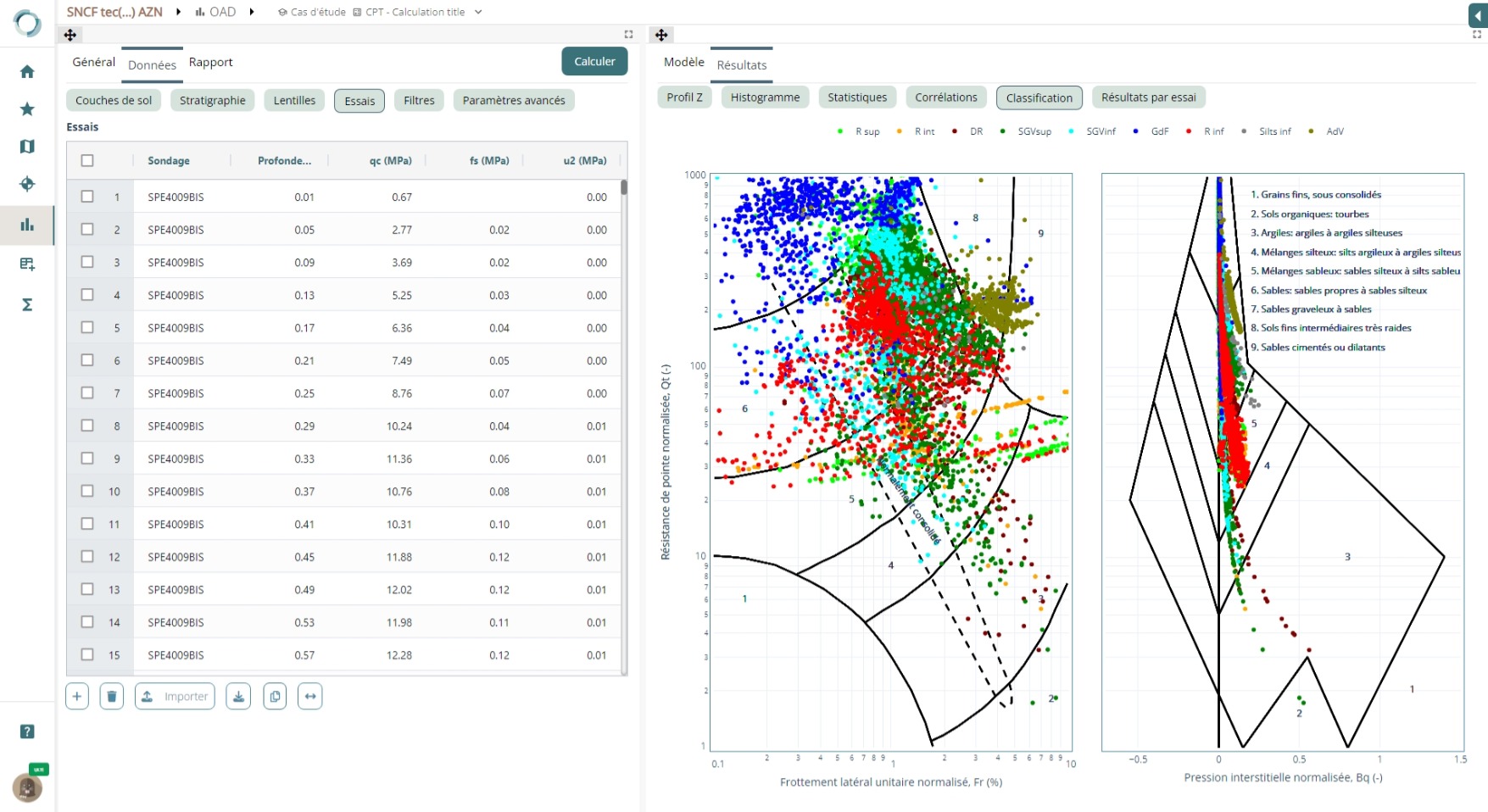
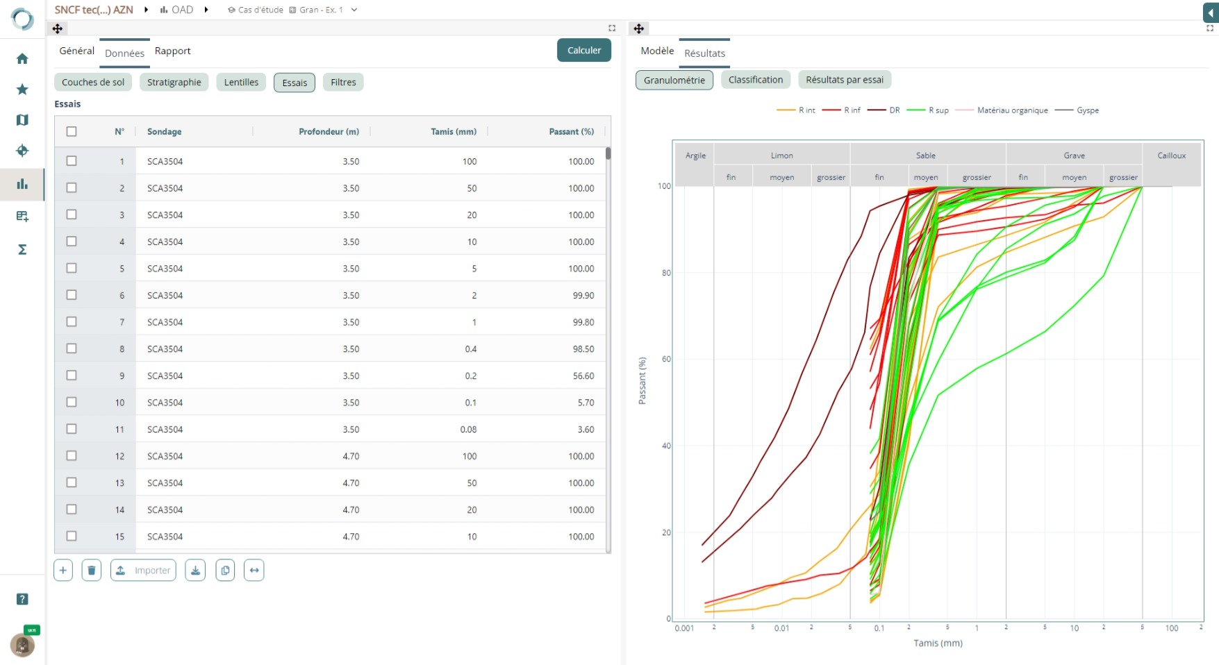

Decision-making tools
Orbow includes a library of decision support tools that allow you to analyse your data in depth, define analysis scenarios for groups or geographic areas, and estimate representative values using statistical calculations.
Each data type can be used to display graphical representations, sections and 3D blocks.
The tools allow you to generate automated reports.

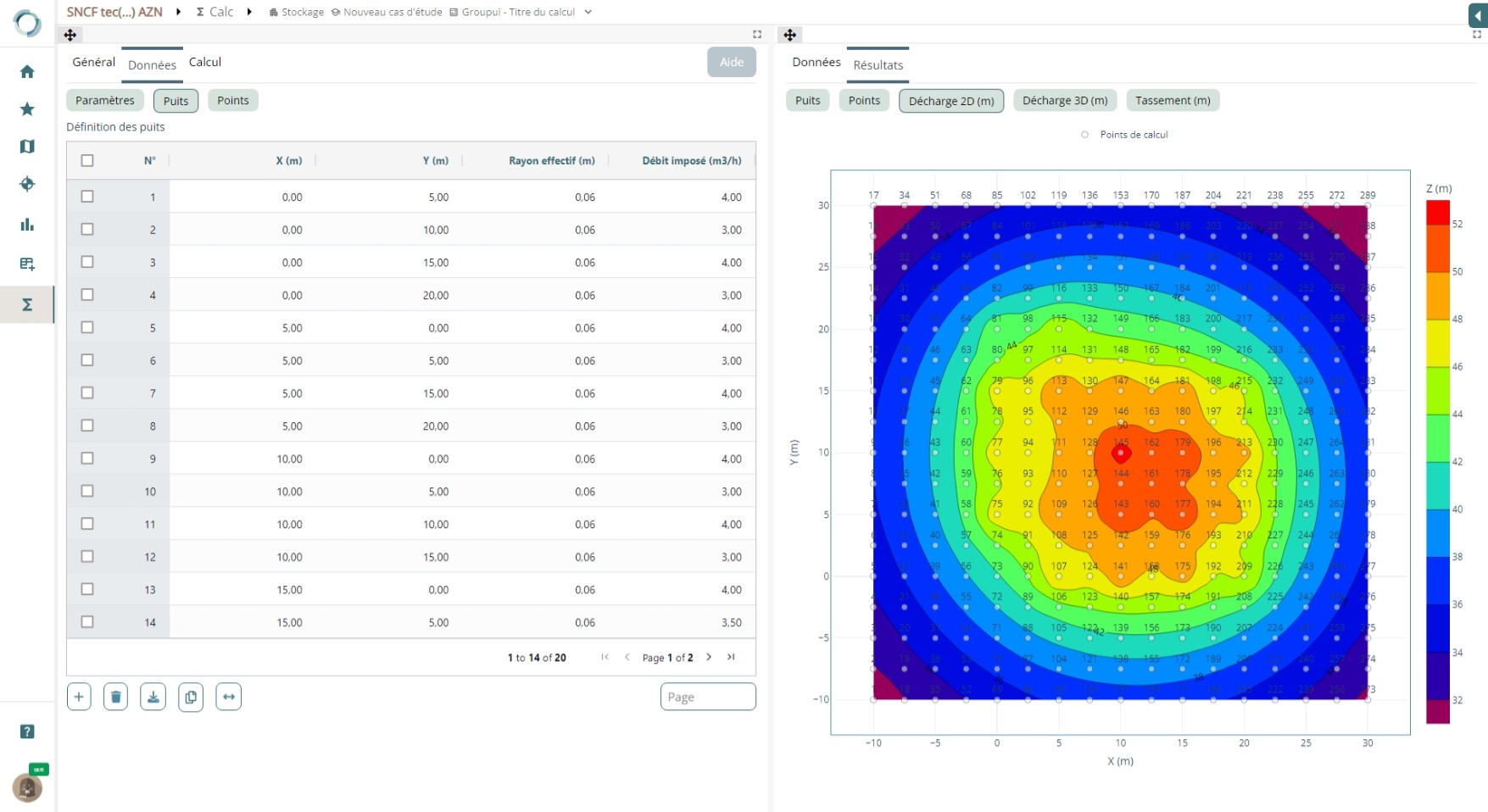
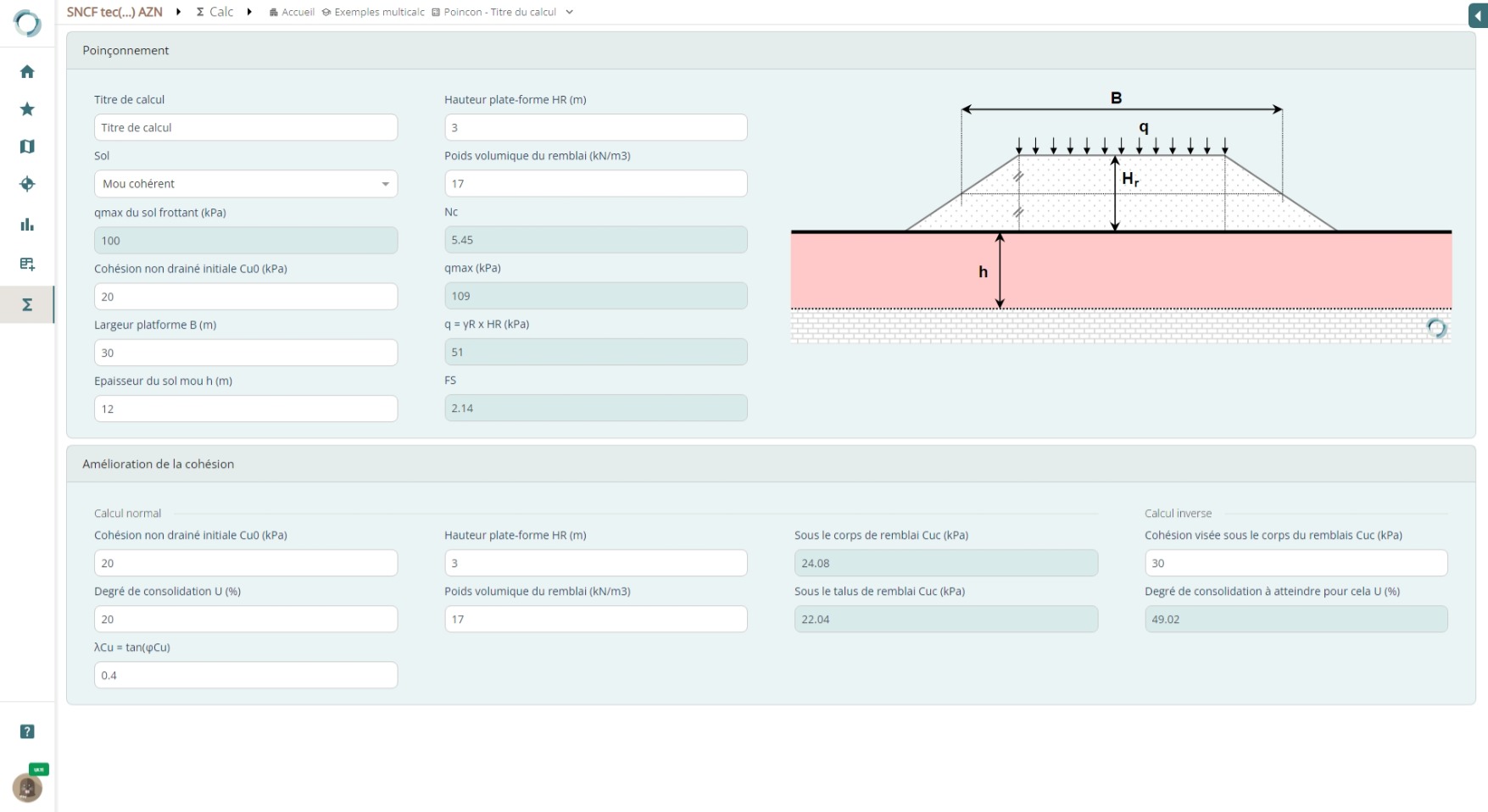
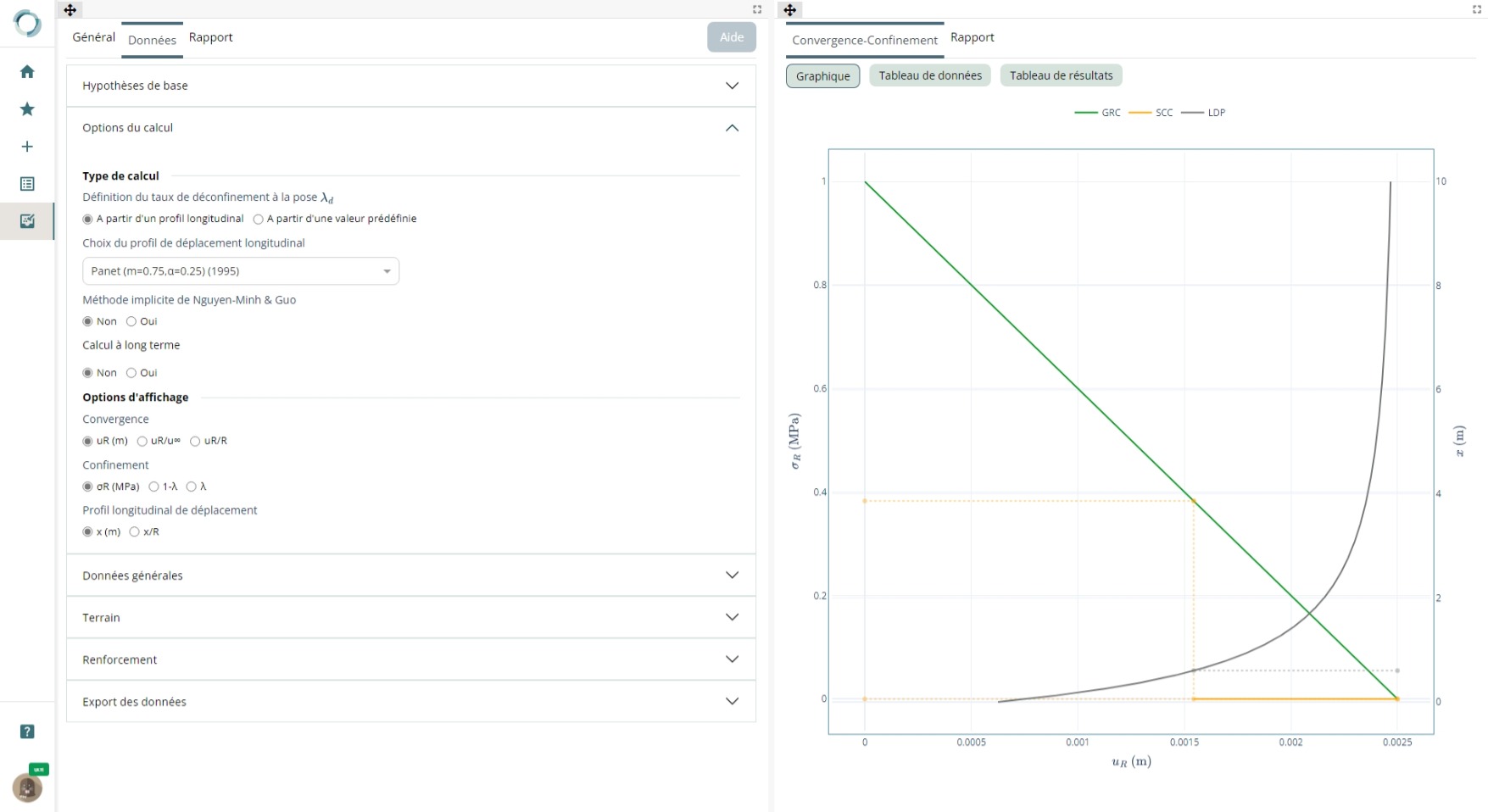
Pre-dimension your structures
Calculation tools
Orbow also contains a library of calculation modules for simple parametric pre-dimensioning, in addition to the detailed modelling that can be done using the softwares in the terrasol suite: foundation, drawdown, stability and tunnel calculations – the list of modules is constantly growing.
terrasol also offers a customised tool development service for its customers.


Exclusive geotechnical modules

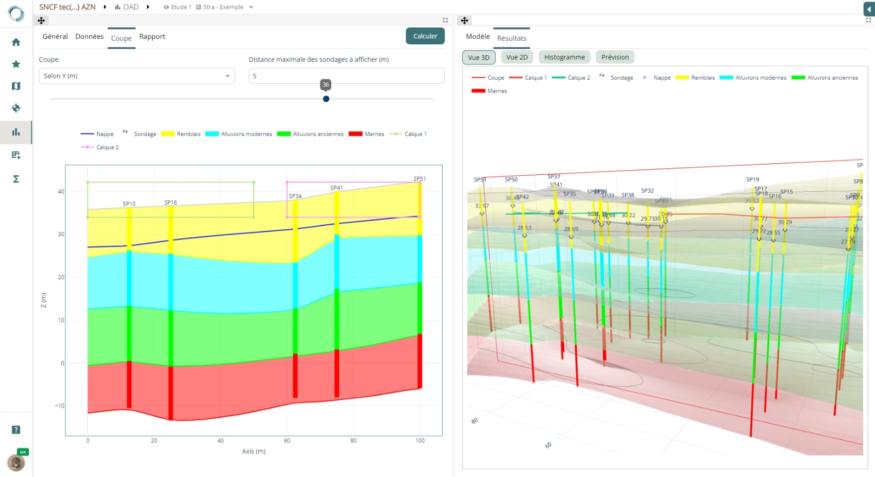
Stra
3D blocks and sections
Explore stratigraphy in 3D using a set of boreholes and visualise your cross-sections in just a few clicks.
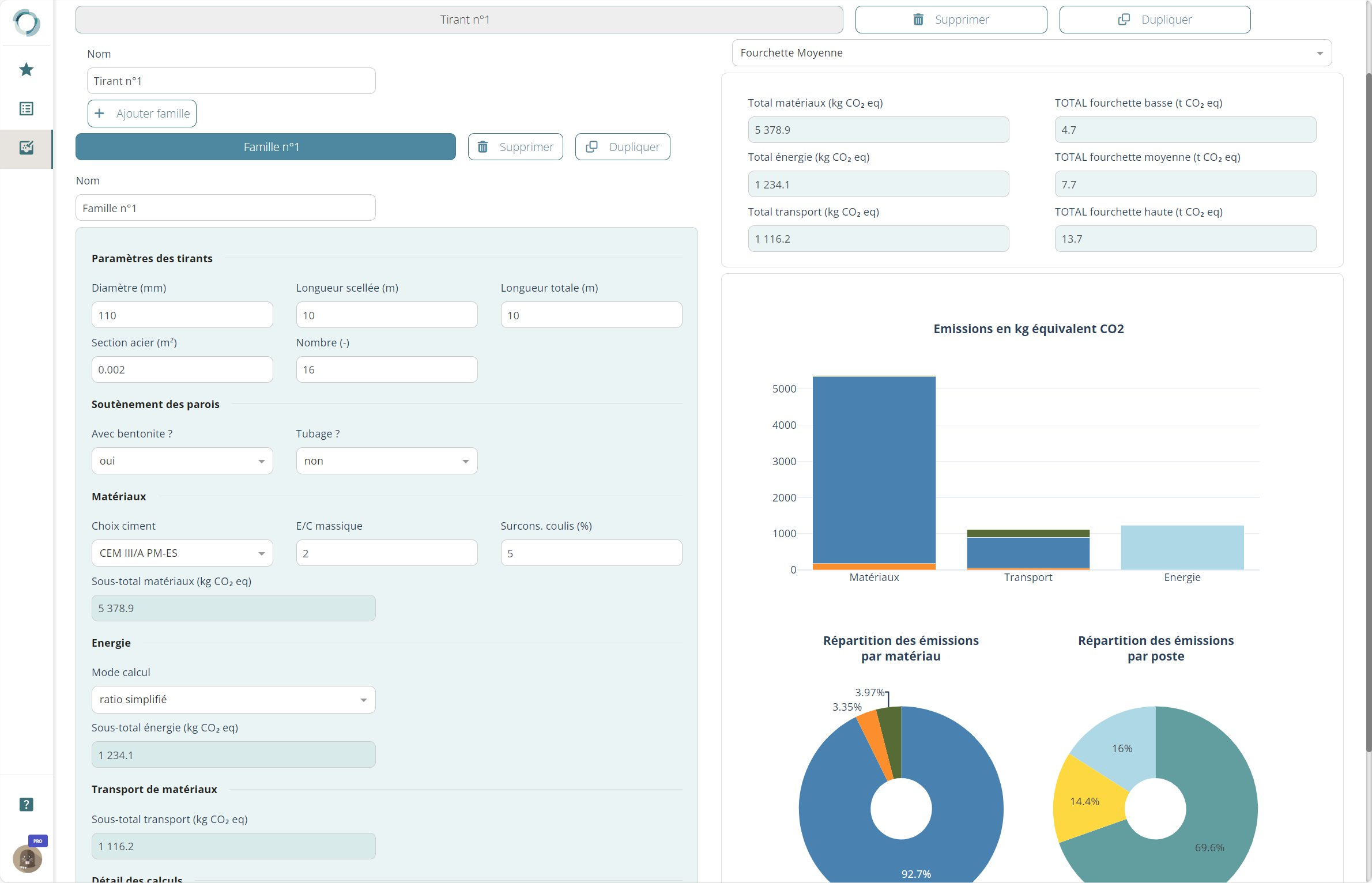
Ecow
Environmental assessment of your solutions
Simply assess and compare the carbon emissions and other environmental impacts of the structures and solutions you design in just a few minutes.

Shade
Module for dimensioning shade structure foundations
Using a set of load distributions, quickly compare and evaluate different foundation solutions (shallow foundations, micropiles, hollow auger piles).
What makes all the difference?

All-in-one
Business data management, integrated
analysis and calculation tools, collaboration, document storage.

Proven
Our geotechnical engineers are involved in the design and are our first users.

Secured
You’re at home: we create your account, you manage it, and the data is on a Cloud in France.

Innovative
Our tools meet the needs of our engineers and are constantly being improved.
A clear, flexible licensing system
The number of licences is the number of simultaneous connections to the platform. 100 users for a single licence? No problem! We can adjust your number of licences at any time.
FREE
Consult your data and share free access to your projects with other companies or your customers.
BASIC
Edit and use your data, with access to the Stra, Fondsup and Fondprof modules.
PRO
BASIC + access to all library modules.
ULTI
PRO + Engineer Support. Benefit from this licence for 1 year for any Cloud licence to our desktop software.
MODULE
Use of a calculation module of your choice, simplified interface, no access to the survey database.
EDU
Educational licence for schools and universities. Access to all features for an unlimited number of users
Contact us for prices!
They are already using Orbow


Who are we?
terrasol, an expert subsidiary of the setec group, has been a major player in geotechnical engineering for over 45 years. We work with clients, contractors and engineers in France and abroad to guarantee the stability of structures, optimise projects and meet environmental challenges.
In addition to our engineering, project management and diagnostic services, we design innovative geotechnical software such as Talren, K-Réa and Foxta, and offer specialist training courses to pass on our expertise.
With Orbow, our collaborative platform, we simplify the management of geotechnical projects by centralising data, analyses and calculation tools to support your teams at every stage.